The pursuit of untouched wilderness calls to a distinct breed of adventurer. Imagine standing on a summit, gazing at countless other peaks. Many lack any discernible path. The video above hints at this formidable challenge. It focuses on bushwhacking trailless mountains. This demanding endeavor captivates the most dedicated peak baggers.
Venturing off-trail requires more than just enthusiasm. It demands meticulous preparation. Expert navigation skills are essential. A deep understanding of the backcountry environment is critical. We delve into the complexities of tackling these remote objectives.
Mastering Off-Trail Navigation for Remote Peaks
Success in trailless terrain hinges on superior navigation. Forget worn paths and cairns. You become your own pathfinder. Your primary tools are robust. They include a topographic map and a reliable compass.
Advanced Map Reading and Terrain Interpretation
- **Contour Lines:** These lines reveal the slope’s steepness. They show the shape of the land. Closely spaced lines indicate steep pitches. Widely spaced lines suggest gentler terrain.
- **Drainages and Ridges:** Water features and high ground define your route. Use them as natural handrails. They guide you through dense forest.
- **Saddles and Summits:** Identify key checkpoints. These help confirm your location. False summits are common deceptions. Prepare for them.
Beyond basic features, study micro-terrain. Small cliffs or boggy areas can impede progress. Anticipate these obstacles. Plan alternative routes proactively. Aerial imagery, like satellite views, offers invaluable insights. They reveal vegetation density. They show potential open areas. They help visualize the route’s difficulty.
Precision Compass Work and Bearing Fundamentals
A compass is your constant guide. Accurate declination settings are crucial. They align magnetic north with true north. Take precise bearings. Walk on an azimuth. This prevents drifting off course. Aiming off is a smart tactic. It targets a specific feature, not the peak itself. This simplifies finding your objective. Triangulation helps pinpoint your exact location. Identify three known points. Take their bearings. Plot them on your map. This confirms your position with confidence.
GPS as a Supplementary Aid in Wilderness Bushwhacking
GPS devices are powerful secondary tools. They offer real-time location data. They track your progress. Pre-loading waypoints is essential. Save your car’s location. Mark critical junctions. Yet, GPS batteries can fail. Signal loss occurs. Always prioritize map and compass mastery. GPS supplements, it does not replace.
Planning Expeditions for Untracked Wilderness
The workflow for bushwhacking trailless mountains extends beyond navigation. It involves comprehensive planning. This ensures safety and efficiency. Speaker 1’s question regarding workflow is vital. It prompts a multi-faceted approach.
Route Selection and Reconnaissance
Choosing the right route is paramount. Look for the path of least resistance. This might mean following a ridge line. It could involve ascending a drainage. Consider the “herd paths.” Sometimes faint, these offer slight relief. They save energy. Research past trip reports. Learn from others’ experiences. Note challenges encountered. Understand typical travel times. Terrain varies wildly. Dense spruce traps frustrate progress. Open hardwood forests offer easier passage. Always build in contingency time. Delays are inevitable off-trail.
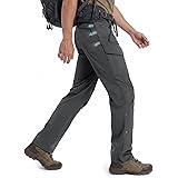
Gear Specifics for Remote Trailless Climbs
Standard hiking gear is insufficient. Specialized equipment is a must. Robust, tear-resistant clothing protects from brush. Durable pants prevent scrapes. Sturdy boots with excellent ankle support are critical. Carry extra water. Or, bring a reliable filter. Headlamps are indispensable. Even for day trips. A first-aid kit is non-negotiable. Include blister treatment. Carry a signalling device. A whistle or personal locator beacon (PLB) is wise. A small folding saw or machete aids in clearing dense thickets. This is specific to certain regions and terrain types.
Emergency Preparedness and Risk Mitigation
Even expert bushwhackers face risks. Comprehensive emergency planning is vital. Inform someone of your itinerary. Provide your planned route. Give expected return times. Pack a bivy sack or lightweight tarp. This offers emergency shelter. Know basic wilderness first aid. Carry an emergency communication device. A satellite messenger allows texts beyond cell service. Assess weather forecasts constantly. Rapid changes are common. Be prepared to turn back. Prioritize safety over summiting. This is always the correct decision.
The Allure of Untracked Peaks: Beyond the Trail
Why do adventurers seek these trailless challenges? Speaker 2 offers insight. “I like to do what other people aren’t doing.” This sentiment resonates deeply. It speaks to a desire for unique accomplishment. It highlights exploration and personal challenge.
The Challenge of “Composing Your Own List”
Many peak baggers follow established lists. The Adirondack 46ers is one example. Yet, some lists are self-created. Speaker 2 mentions climbing 601 peaks above 2,500 feet. Achieving “first finisher” status is impressive. This highlights the drive. It shows the dedication to personal goals. These lists often target specific elevations. They focus on regional peak counts. Completing such a list means navigating hundreds of unique bushwhacks. Each presents its own set of problems. Each offers a distinct reward.
Solitude and Connection to Wilderness
Trailless peaks offer profound solitude. You rarely encounter others. This fosters a deep connection. You become immersed in nature. The quiet is absolute. The environment is pristine. This experience is unlike crowded trails. It builds self-reliance. It strengthens mental fortitude. It demands unwavering focus. This deep engagement is a core draw. It defines the bushwhacking experience.
Environmental Stewardship in Remote Areas
With freedom comes responsibility. Following Leave No Trace principles is paramount. Pack out everything you pack in. Minimize your impact. Avoid sensitive vegetation. Travel on durable surfaces where possible. Disperse human waste properly. Leave what you find. Respect wildlife. These principles are even more critical. Pristine wilderness is fragile. It is up to us to protect it. For those who embrace bushwhacking trailless mountains, this stewardship is a given. It is part of the ethos.
Blazing a Path: Your Bushwhacking Q&A
What is bushwhacking?
Bushwhacking is the challenging activity of hiking off established trails to climb mountains or explore wilderness areas that do not have a discernible path. It involves navigating through dense terrain without relying on marked routes.
Why do people go bushwhacking?
People go bushwhacking to experience untouched wilderness, find solitude, achieve unique personal challenges, and feel a deep connection to nature away from crowded trails. It offers a sense of exploration and self-reliance.
What are the most important tools for navigating while bushwhacking?
The most important tools for navigating off-trail are a topographic map and a reliable compass, as you will be creating your own path. A GPS device can also be used as a helpful secondary aid, but should not replace map and compass skills.
What kind of special gear do you need for bushwhacking?
You need specialized gear like robust, tear-resistant clothing, durable pants, and sturdy boots with good ankle support to protect you from brush and difficult terrain. It’s also vital to carry extra water, a headlamp, and a comprehensive first-aid kit.